Free offline mobile .pdf maps, online city may, beach map, bus routes and .pdf maps with directions to pueblos and destinations near Mazatlan including Concordia, Copala, Cosala, El Quelite, El Rosario, La Noria, Lake El Salto, San Ignacio and Teacapan, and sightseeing attractions like Las Labradas, Meseta de Cacaxtla, Barras de Piaxtla and Playa el Caimanero in Rural Sinaloa, Mexico
Free maps of Mazatlán and Sinaloa Download free maps of Mazatlan and to Rural Sinaloa towns 22 free Mazatlán maps that can be downloaded as mobile-friendly .pdf's!
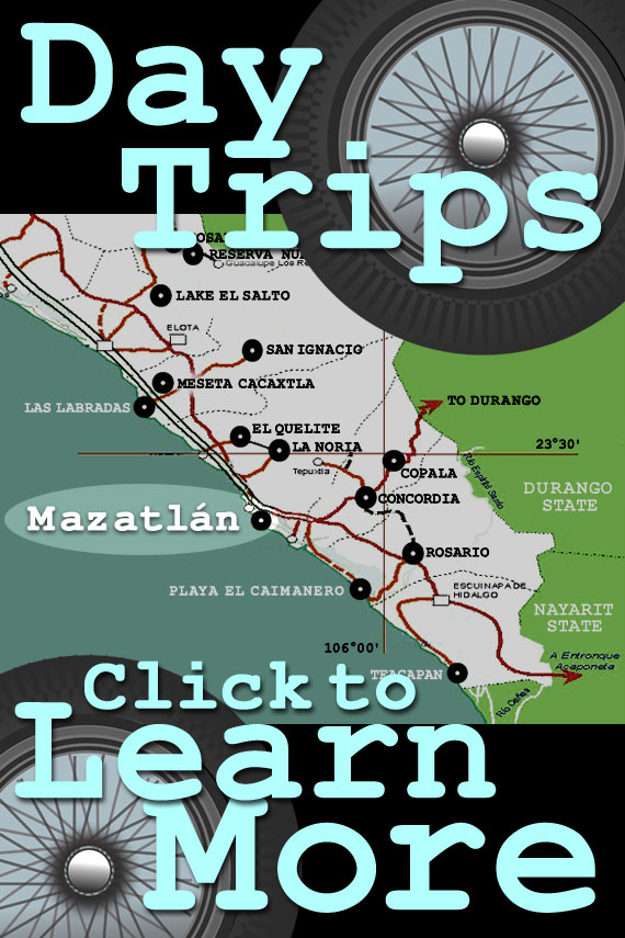
Click below to download pdf maps and driving directions to pueblos, communities and other destinations within Rural Sinaloa and Durango State.
All of the destinations are close enough to visit on Mazatlan day trips if you have a car.
The furthest locations are best visited with an overnight stay, such as a Mazatlan - Durango excursion on the Federal Highway 40D toll road: as wonderful as Mazatlan is, it would be a shame to rush back...
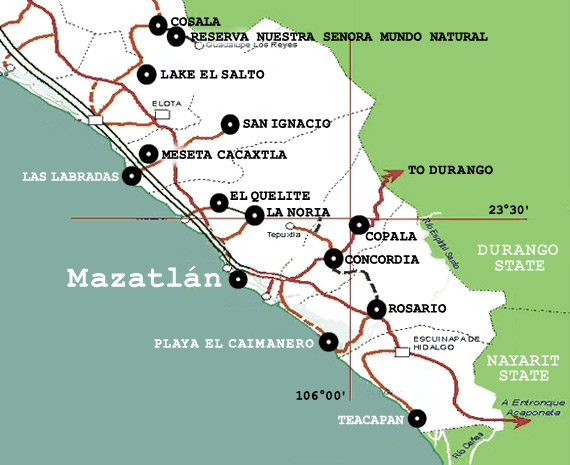
Overview map of Day Trips and Southern Sinaloa State
We offer this simplified map of southern Sinaloa below for general orientation to where the various Mazatlan day trip destinations are located.
Road maps of Mazatlán and Sinaloa
The best paper street map of Mazatlan is produced by Guia Roji, and is widely available wherever Guia Roji maps are sold such as OXXOs, AutoZone, and other retailers.
Detailed paper road and topographical maps of Sinaloa State have, traditionally, not necessarily been easy to obtain locally.
INEGI -- Instituto Nacional de Estadistica Y Georgaphia, the official Mexican Government statistic and mapping organization -- produces detailed maps of virtually all of Mexico, but their products are rarely available in town.
For those interested in detailed INEGI maps they can be ordered directly from INEGI online at inegi.gob.mx (Spanish language only website), or through a major reseller like mexicomaps.com, whose website is in English.
The best commonly available Sinaloa State road maps are also the Guia Roji series, which provide some topographical information. Guia Roji maps of Sinaloa -- as well as other parts of Mexico -- are available at most OXXOs, AutoZone, and other retailers.
Unfortunately, the highly detailed Guia Roji map for Sinaloa State is at a smaller scale than the series for the rest of Mexico, and as a result is difficult to read.
Sinaloa Today
Modern Sinaloa isn't just rural Pueblos Magico gems -- it is a vibrant economic and cultural entity that is making its mark not just on the economy and culture of Mexico, but on the world. Enjoy this video overview of Modern Sinaloa!
Video about the beautiful state of Sinaloa, Mexico
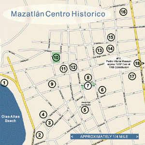
Zoomable city map of Mazatlan and free .pdf maps with directions to Rural Sinaloa towns of Concordia, Copala, Cosala, El Quelite, El Rosario, La Noria, San Ignacio, Barras de Piaxtla, Teacapan and more!